Exploring the River Culm

Our nearest town, Cullompton, takes its name from “River Culm”. This 17-mile long meandering waterway is the largest tributary of the River Exe and one of the most accessible rivers in Devon.

This article was written on 19 October 2022
and is a 2 minute read

< Return to listing

As you would expect, the river provides life and home to a wide range of plants and wildlife. Broad grazing marshes, pasture and woodland are all part of the ecosystem. The Connecting the Culm Project tells us that thousands of species of plants and insects have been recorded. It’s a beautiful and largely unspoilt stretch of water and we’re going to visit a few stops along its route.

Whilst the river ‘rises’ (starts) at a spring up at Culmhead on the Blackdown Hills before flowing through Hemyock, we join it at Culmstock, whose name, literally means “Farm on the River Culm”…

Culmstock

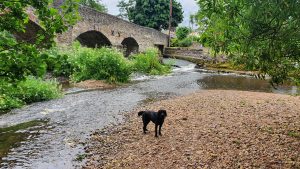
Culmstock is famous for its Elizabethan Beacon, a stone hut high on the hills overlooking the village, once used as part of the network to warn of arrival of the Spanish Armada. The village itself sits either side of the Culm and its two halves are brought together by an old stone bridge. (Find out about the bridge’s spooky mythology on the Visit Mid Devon website!) On one side of the bridge sits the Strand Stores; a deli and café popular with walkers and cyclists. Walk down over the bridge to find the Culm Valley Inn serving a wide range of high-quality, locally-sourced food. Its outdoor seating area is where the old railway platform was located and is decorated with large wooden sculptures! Cross the bridge from the pub car park to find Culmstock river beach: a safe and fun, pebbled area for children to splash about in the river.

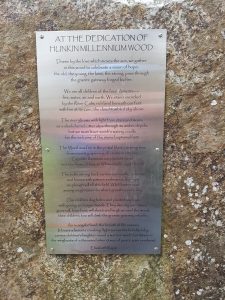
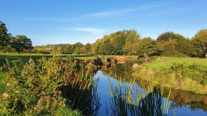
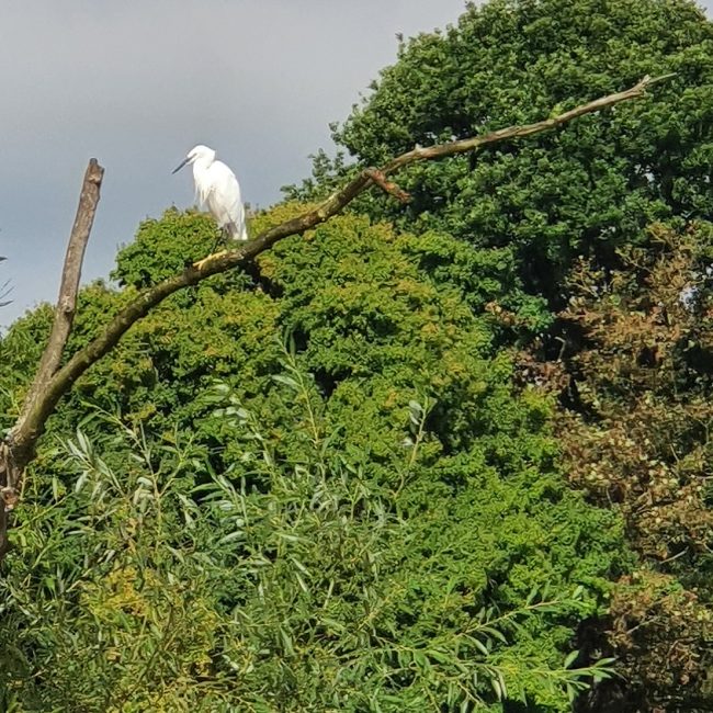
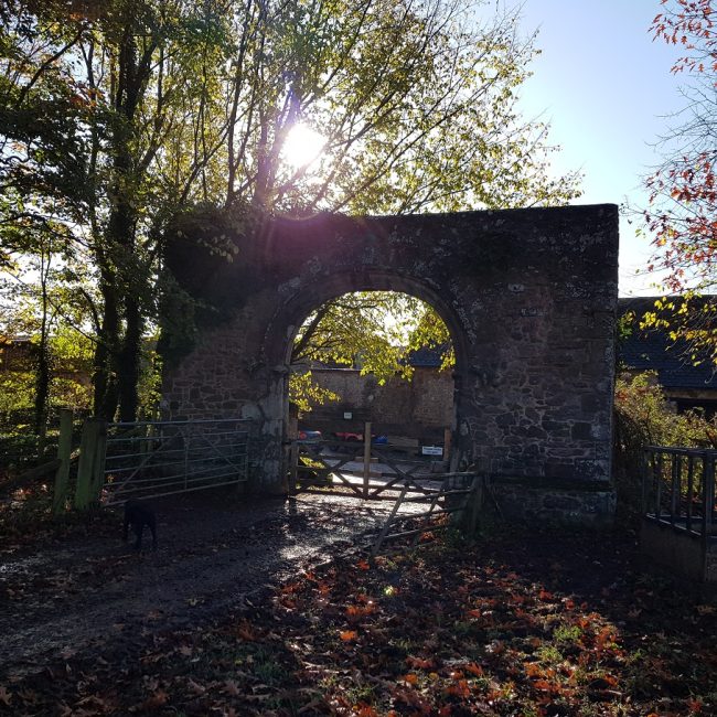
From the river beach, you can walk along the river, following some of the old railway line, through the fields to Hunkin Wood. This small patch of broadleaved Millenium woodland is home to a beautiful granite gateway, engraved with the poetry of Elizabeth Rapp. There are also further swimming spots for a bit of wild swimming.

Exit Hunkin Woods over the small wooden bridge to continue along well-marked, flat footpaths following the river to Uffculme.

Bridwell Orangery Cafe at Forest Glade

Uffculme

As you reach the edge of Uffculme, you’ll go through a small residential/commercial area to meet the road opposite a large agricultural feed mill. By turning right, you’ll see the village hall. Bear left just before the hall and follow the footpath behind it along the old railway line to Coldharbour Mill. Uffculme was a significant part of the British wool industry and Coldharbour Mill, built right at the end of the C18th is a working wool museum. Visit on a ‘Steam Up’ day to see the well-maintained historic machinery at full-pelt.

If you continue past the hall, you’ll reach the village centre, with its square, shop and fish and chips takeaway. A stone’s throw from the mill is another wonderful place to visit: Bridwell Park, the home of Lord Ivar Mountbatten. The grounds only opened to the public in 2015. Dogs are welcome on leads; it’s free to explore the deer park and, if you need a rest stop, their Orangery Café serves wonderful coffee and cake.

To spend more time river-side, turn left at the feed mill, where you’ll see a bridge with a gate on the opposite wall and steps leading down to a footpath, which allows you to carry on alongside the water.

Photo: The Orangery at Bridwell

Little Egret at Forest Glade

Cullompton

A short drive takes you from Uffculme to our nearest town, Cullompton. According to the website of the Walronds, a recently restored historic building in the town centre, Cullompton is an ancient settlement – Roman remains have been found here in fact – taking its name from ‘culm’ which is a Celtic word for stream and ‘ton’ meaning settlement or farmstead. There are frequent creative events at the Walronds, craft fairs and a regular Farmers’ Market in the town. There are also some rather good cafes along Cullompton High Street. Try the Bakehouse, or the newly-opened Lime Tree Cafe.

To enjoy a walk along the river itself, park somewhere in the housing estate opposite Mole Valley Farmers. Go past the play area in River Drive and follow the path beyond to find large, open grassland by the river. Whilst its a little noisy here with the sound of the motorway, it’s a lovely spot and we often spy dippers on the rocks and little egrets in the trees here! Maps for some excellent circular walks in Cullompton are available on the Cullompton Town Council Website.

Photo: Little Egret

Archway at Columbjohn at Forest Glade

Killerton

Our final stop on the River Culm is Killerton. We’ve told you about the wonderful grounds at Killerton before, but today, we’re looking at one walk in particular: the footpath from Ellerhayes Bridge to Columbjohn. Entry is through the National trust car park at Ellerhayes. (This car park is rather tiny, but cross the road bridge and bear right to find another, free parking area). A flat walk takes you along the bottom of Park Woods, through the managed treescape and pasture land (where there are currently Devon ruby red cattle grazing). The area by the river here is rather rutted, but pretty nonetheless and an interesting, if incongruous feature is the large late C16th archway, which is at the entry to an ancient and now demolished mansion house. Find out about the interesting work the Connecting the Culm Project is doing to protect the land in this part of the river and surrounding fields.

It’s here we leave the Culm to wend its way onward to join the River Exe near Stoke Canon on the outskirts of Exeter.

Please note: all information is correct to the best of our knowledge, but please always check relevant website, OS maps and other sources before travelling to a particular place. If you find a spot on the River Culm that you particularly love, please do let us know!

Photo: The Archway at Columbjohn (M Thorne)